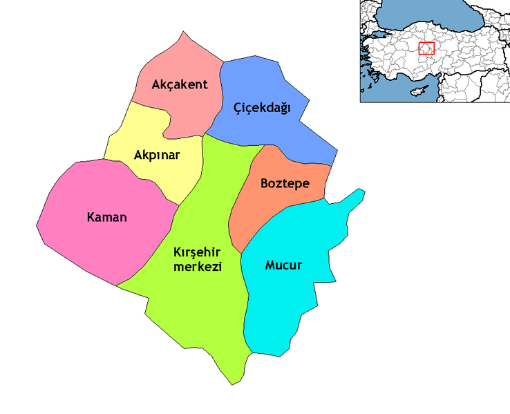
فائل:Kırşehir districts.png

اس نمائش کا حجم: 738 × 599 پکسلز۔ دیگر تصمیمات: 296 × 240 پکسلز | 591 × 480 پکسلز | 948 × 770 پکسلز۔
اصل فائل (948 × 770 پکسل، فائل کا حجم: 19 کلوبائٹ، MIME قسم: image/png)
فائل کا تاریخچہ
کسی خاص وقت یا تاریخ میں یہ فائل کیسی نظر آتی تھی، اسے دیکھنے کے لیے اس وقت/تاریخ پر کلک کریں۔
| تاریخ/وقت | تھمب نیل | ابعاد | صارف | تبصرہ | |
|---|---|---|---|---|---|
| رائج الوقت | 23:23، 16 اکتوبر 2009ء |  | 948 × 770 (19 کلوبائٹ) | ZooFari | Trimmed off border |
| 01:18، 29 دسمبر 2008ء |  | 1,056 × 816 (20 کلوبائٹ) | One Homo Sapiens | Corrected text where İ,Ş,ı,ğ,or ş occurs in name. Source: [statoids-com]. Increased font size and enhanced color differences among adjacent districts. | |
| 15:01، 15 اپریل 2007ء |  | 1,056 × 816 (25 کلوبائٹ) | Denizz~commonswiki | == Summary == Map of the districts of Kırşehir province in Turkey. Created by Rarelibra 22:00, 1 December 2006 (UTC) for public domain use, using MapInfo Professional v8.5 and various mapping resources. == Licensing == {{PD-self}} |
روابط
درج ذیل 10 صفحات اس فائل کو استعمال کر رہے ہیں:
فائل کا عالمی استعمال
مندرجہ ذیل ویکیوں میں یہ فائل زیر استعمال ہے:
- ar.wiki.x.io پر استعمال
- ast.wiki.x.io پر استعمال
- azb.wiki.x.io پر استعمال
- br.wiki.x.io پر استعمال
- ca.wiki.x.io پر استعمال
- ceb.wiki.x.io پر استعمال
- de.wiki.x.io پر استعمال
- diq.wiki.x.io پر استعمال
- en.wiki.x.io پر استعمال
- en.wiktionary.org پر استعمال
- eo.wiki.x.io پر استعمال
- es.wiki.x.io پر استعمال
- eu.wiki.x.io پر استعمال
- fa.wiki.x.io پر استعمال
- fi.wiki.x.io پر استعمال
- fr.wiki.x.io پر استعمال
- fy.wiki.x.io پر استعمال
- glk.wiki.x.io پر استعمال
- hu.wiki.x.io پر استعمال
اس فائل کا مزید عالمی استعمال دیکھیے۔
