موغلا
موغلا (انگریزی: Muğla) ترکی کا ایک شہر جو ایجیئن علاقہ میں واقع ہے۔[3]
| بلدیہ | |
 Top left: Ölüdeniz, Top right: A sculpture in مرماریس, Middle left: Castle of St. Peter in بودروم, Middle right: Halicarnassus Theatre, Bottom left: Otel Turunç, Bottom right: Tomb of Amyntas. | |
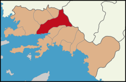
 Location of Muğla district within Muğla Province. | |
| ملک | |
| Region | ایجیئن علاقہ |
| صوبہ | Muğla |
| First cited | In 2nd century BC under the indigenous name of Mobolla during its passage from a Carian federation linked with Taba (تاواس) to جزیرہ روڈز domination. |
| Lycian or Carian to Menteşe Turkish period (14th century) | Cited as Mobolla with an intermediate form Mogolla attested later. |
| Menteşe Turkish period (13th century) to the present | Cited as Muğla and a Menteşe urban center, after 1426 center of an سلطنت عثمانیہ ولایت عثمانی, after 1923 center of the homonymous province under the ترکی |
| Municipalities | 5 |
| حکومت | |
| • ناظم شہر | Osman Gürün (CHP) |
| رقبہ[1] | |
| • ضلع | 1,660.55 کلومیٹر2 (641.14 میل مربع) |
| بلندی | 660 میل (2,170 فٹ) |
| آبادی (2012)[2] | |
| • شہری | 64,706 |
| • ضلع | 99,158 |
| منطقۂ وقت | مشرقی یورپی وقت (UTC+3) |
| • گرما (گرمائی وقت) | مشرقی یورپی وقت (UTC+3) |
| ٹیلی فون کوڈ | (+90) 252 |
| Licence plate | 48 |
| ویب سائٹ | Muğla Municipality Governorship of Muğla |
تفصیلات
ترمیمموغلا کی مجموعی آبادی 660 میٹر سطح دریا سے بلندی پر واقع ہے۔
مزید دیکھیے
ترمیمحوالہ جات
ترمیم| ویکی ذخائر پر موغلا سے متعلق سمعی و بصری مواد ملاحظہ کریں۔ |
- ↑ "Area of regions (including lakes), km²"۔ Regional Statistics Database۔ Turkish Statistical Institute۔ 2002۔ اخذ شدہ بتاریخ 05 مارچ 2013
- ↑ "Population of province/district centers and towns/villages by districts - 2012"۔ Address Based Population Registration System (ABPRS) Database۔ Turkish Statistical Institute۔ اخذ شدہ بتاریخ 27 فروری 2013
- ↑ انگریزی ویکیپیڈیا کے مشارکین۔ "Muğla"
|
|